
AERIAL CONTEXT.
INVESTIGATIVE DETAIL.
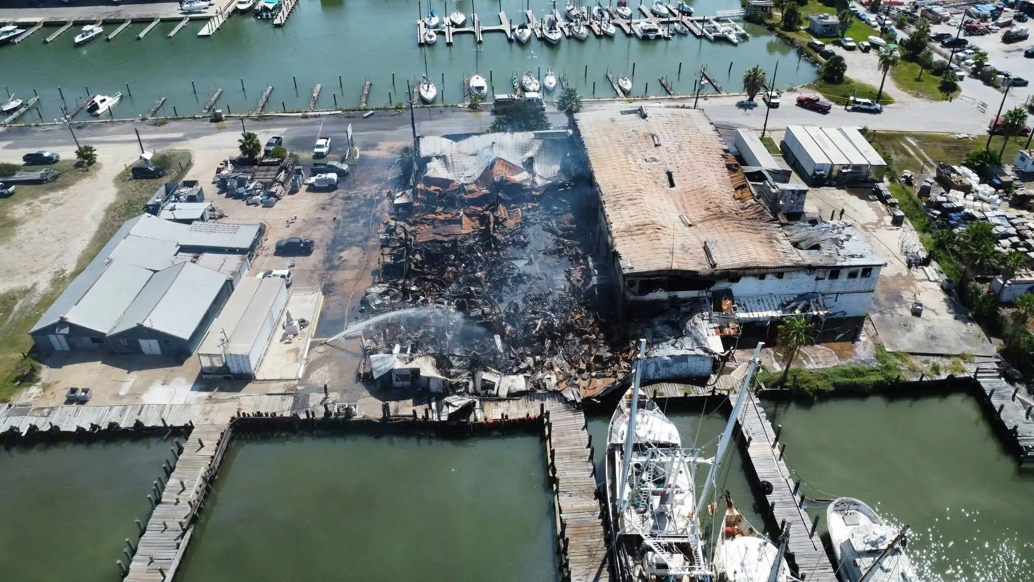
Vector uses planned aerial documentation to preserve roof conditions, exterior fire effects, site relationships, debris distribution, access limitations, and large-area context that ground photography may not fully capture.
PLAN THE VIEW.
DOCUMENT THE QUESTION.
Aerial work begins with the investigative question. Coverage, altitude, viewing angle, overlap, reference points, safety, and site constraints are selected to produce an organized technical record.
DEFINE
Identify the conditions, relationships, or inaccessible areas the flight must document.
PLAN
Establish coverage, flight path, viewing angles, overlap, reference points, and site restrictions.
CAPTURE
Record systematic aerial imagery before conditions are altered or critical context is lost.
INTEGRATE
Connect aerial views with ground photographs, measurements, scan data, diagrams, and findings.
SEE THE RELATIONSHIPS
THE GROUND CANNOT SHOW.
Aerial imagery helps orient the technical record and preserve the spatial relationships between structures, systems, exposures, terrain, and damaged areas.
ROOF &
EXTERIOR
Fire effects, openings, roof geometry, storm damage, and difficult-access conditions.
SITE &
EXPOSURES
Adjacent structures, utilities, vegetation, vehicles, terrain, and exposure pathways.
DEBRIS &
DISTRIBUTION
Large-area debris fields, displaced materials, collapse, and relevant site patterns.
CHANGE &
PROGRESS
Conditions before and during excavation, demolition, repair, or evidence recovery.
ONE VIEW DOES NOT
TELL THE WHOLE STORY.
Drone imagery supplements a systematic examination. It does not replace ground-level observations, physical evidence, measurements, or technical analysis.
A CONNECTED SCENE RECORD
When aerial views are coordinated with conventional photography, 3D or 360-degree documentation, diagrams, and physical findings, stakeholders gain a clearer understanding of scene orientation and the relationships relevant to the investigation.
DOCUMENTATION FOR
ACCESS, SCALE, AND CHANGE.
Flight services are matched to the scene, the technical question, and the level of documentation the assignment requires.
FIRE & EXPLOSION
SCENE DOCUMENTATION
Preserve roof systems, exterior elevations, fire effects, collapse, debris fields, and adjacent exposures.
ROOF & CATASTROPHE
ACCESS SUPPORT
Document steep, unstable, storm-damaged, or otherwise restricted areas where conventional photography may be incomplete.
AERIAL MAPPING &
3D INTEGRATION
Capture organized overlapping imagery that can support mapping, spatial reference, measurements, and scene models.
PROGRESSIVE & CHANGE
DOCUMENTATION
Record conditions across investigative phases, excavation, demolition, repair, or other time-sensitive activity.
EXPAND THE VIEW.
PRESERVE THE CONTEXT.
Vector provides investigative aerial documentation when site scale, roof access, exterior conditions, spatial relationships, or changing scene conditions require a broader technical perspective.